Exeter University Department of Archaeology & History and the Institute of Heritage Sciences and the Spanish National Research Council in Spain have recently published a ground breaking Lidar based study on the Roman road network of Devon & Cornwall.
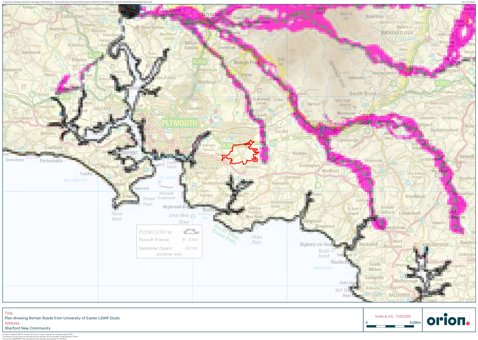
Prior to this study, the understanding of the Roman road network in the SW had barely changed since Ivan Margary’s 1967 publication ‘Roman Roads in Britain’ in which he concluded that Exeter was the focus of the road network in South West England. Exeter University’s study has established that instead of Exeter, it was actually North Tawton that was the centre of the road network which radiated out to the tidal estuaries on the north and south coasts of Devon and down into Cornwall.
As well as identifying the key role of North Tawton in the network, utilising Lidar data analysis, the University team have identified an additional 60-70 miles of additional Roman roads to the west of Exeter where very few had previously been recorded, and using predictive modelling, they have identified further possible routes of previously unsuspected Roman roads. This study will radically change the understanding of the South West in the late prehistoric and Roman period. As the report on the study states:
“…further lengths of road are yet to be identified on the ground. Although it could be argued that roads no longer in use and visible as earthworks might be of pre-Roman, or medieval date, the combination of 1) the consistency in construction practice (agger, quarry pits, terracing), 2) the coherency of the road pattern, and 3) in places the stratigraphic relationship with medieval field systems, argues for it being of Roman origin. The network presented here is only that which has been mapped as an archaeological earthwork visible on LiDAR data and, for example, there are gaps between those segments connected by historic tracks, lanes and roads which are likely to have fossilised the Roman route.”
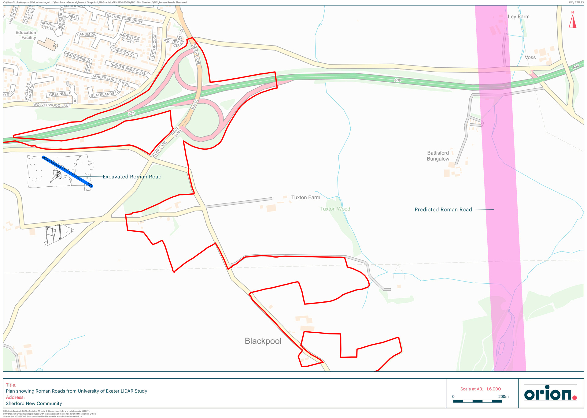
Fitting into these exciting results is the recent discovery of a section of a previously unrecorded and unsuspected Roman road at the proposed business park that forms part of the Sherford new town just to the east of Plymouth. The extensive programme of detailed archaeological investigations that are being undertaken ahead of the construction of the Sherford new town just to the east of Plymouth, has recently discovered a section of a previously unsuspected Roman road. This section of the road which extends across the length of the area towards Plympton demonstrated the construction methods with its crushed slate surface and adjacent drainage points still clearly visible and well-preserved (https://www.bbc.co.uk/news/uk-england-devon-64512968).
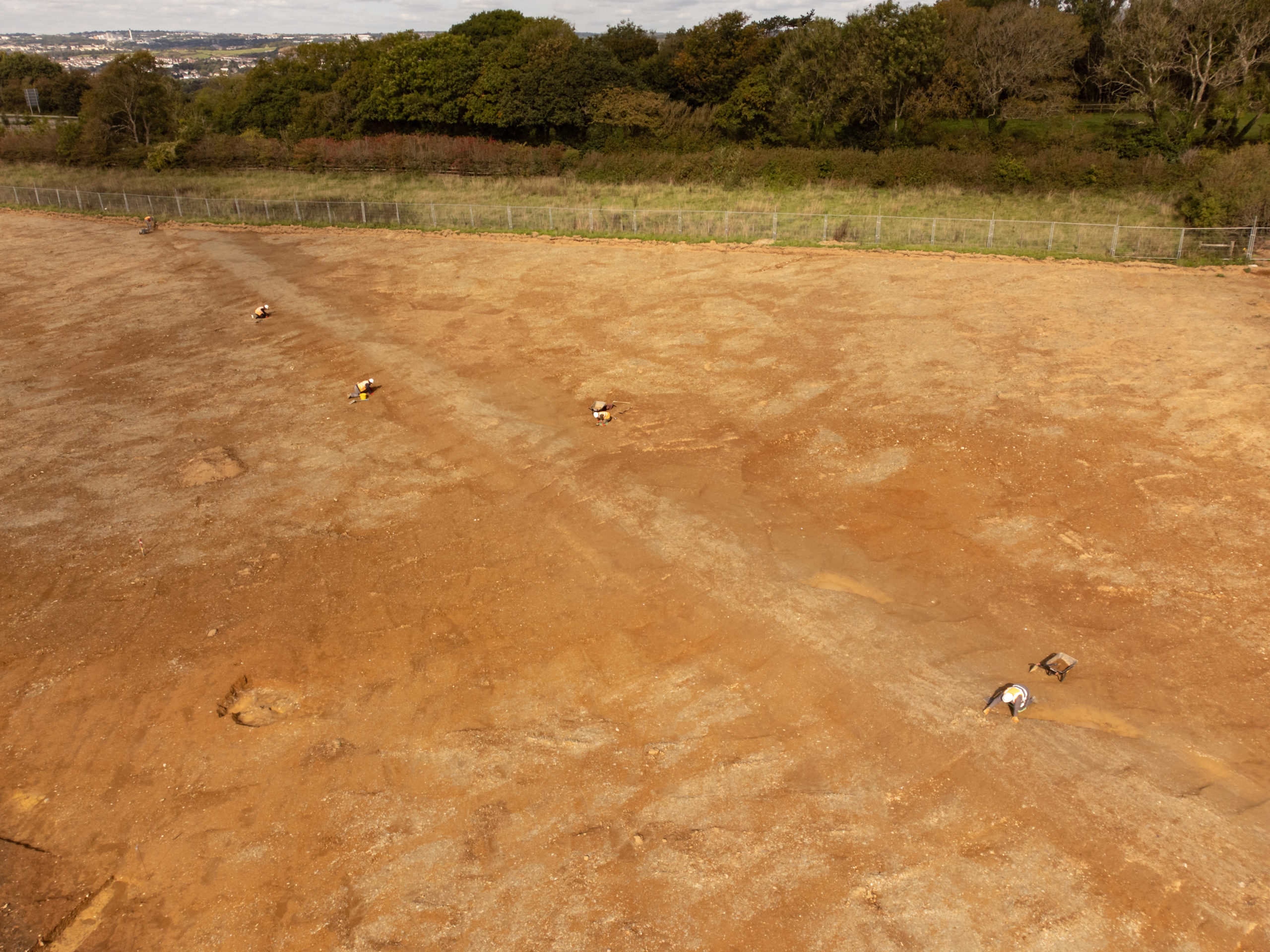
At the time of excavation, the road was undated but due to the way it was constructed was thought to be Roman in date. Optically stimulated luminescence (OSL) dating of the soil immediately below the road surface provided a later Iron Age date (300-130BC) date. As these soils pre-date the construction of the road, this dating has been interpreted as being reasonable evidence for the road being of Roman date and probably at the earlier end of the occupation range.
The section of the Roman road excavated at the Business Park is 1.7km to the west of the position of the Roman road in the area predicted by the Exeter University study. The University study predicted that the road would be orientated north-south but the Business Park road is orientated north west -south east. The different orientation could be that the model’s predicted route is slightly incorrect or that the road excavated at the Business Park is a previously unsuspected spur off the route identified by the University’s modelling. Whichever explanation is correct, the Sherford Business park excavations have confirmed that the predictive modelling by Exeter University appears to be reasonably accurate and, at least in the Plymouth area, definitely closer enough to inform the research questions of future archaeological investigations relating to the Roman occupation and use of the area.
Rob Bourn, Managing Director of Orion Heritage said,
“Enhancing our understanding of not just Devon, but also Britain’s ancient history, the archaeological work at Sherford continues to be fascinating. We are thrilled to work on these important historic investigations, and hope the findings at Sherford help to encourage everyone to take an interest in local history and the secrets under the soil.”
Orion Heritage has been managing the extensive archaeological investigations that are happening ahead of the construction of the new town on behalf of the Sherford Consortium (Vistry Group and Taylor Wimpey).